San Francisco
San Francisco city and county occupy the same land area at the end of the San Francisco peninsula (Figure 27.1). The land area is about 47 square miles with a population of approximately 800,000 people, which is the most densely populated city in California (SF Genealogy 2014). San Francisco was founded in 1776 by the Spanish, who set up a fort and a mission named for Saint Francis of Assisi. The Spanish name for the city was Yerba Buena. At the start of the Mexican American war, Commodore John Sloat sailed into Monterey Bay to claim California for the United States, and Captain John Montgomery arrived in San Francisco a few days later. The city was given the name San Francisco at this time. Sloat and Mont gomery are the names of major streets in San Francisco. The gold rush of 1849 caused a population surge, and California was admitted as a state (San Francisco 2014). The wealth of the gold rush created other business opportunities. Wells Fargo and the Bank of America created a banking industry, Levi Strauss sold dry goods, and Ghirardelli started making chocolate. By 1890, the population was 300,000, and the city was known for its open attitudes, for the arts, and for wealth displayed by large houses (SF Genealogy 2014).
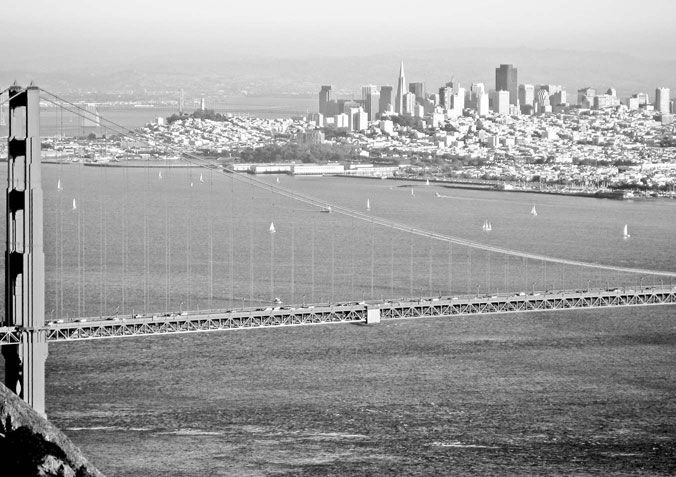
FIGURE 27.1 San Francisco is surrounded on three sides by the Pacific Ocean and San Francisco Bay.
Source: Wikimedia, San Francisco. Public Domain. Photo by Paul.h. 2006.
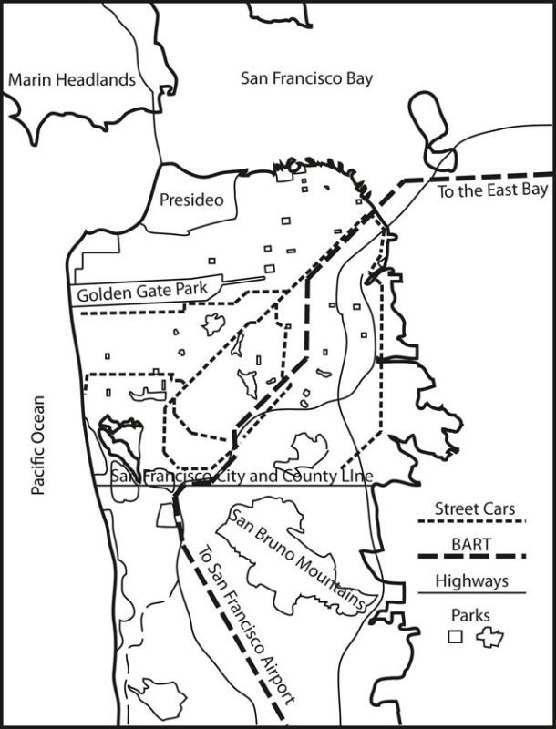
FIGURE 27.2 San Francisco City and County showing parks, street car lines, major highways, and the Bay Area Rapid Transit system.
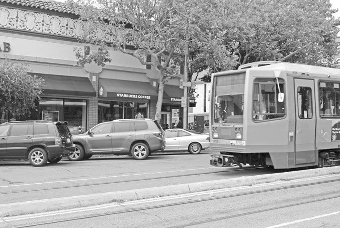
FIGURE 27.3 Neighborhoods center around shopping areas often related to and served by the street car lines.
At 5:12 am on April 18, 1906, the San Andreas fault ruptured causing a great earthquake. Three quarters of the city was either collapsed by the earthquake or burned by the fires after the earthquake. San Francisco was rebuilt on the existing city grid. In the early part of the twentieth century the municipal railway system was developed. The J, L, K, N, and M streetcar lines still operate today, moving people from the neighborhoods into the city center (SFMTA 2014). World War II brought a large flow of people and goods through the port of San Francisco and, after the war, many of the people decided to stay. San Francisco’s open attitudes spawned the beat generation in the 1950s, the hippie summer of love in the mid-1960s, and the gay renaissance in the 1970s. The personal computer industry developed around Stanford University in what is now called Silicon Valley in the 1970s and 1980s, followed by the dot-com companies in the 1990s. This created an entrepreneurial environment that feeds on itself creating many diverse startup companies, which are a mainstay of employment in the Bay Area (San Francisco 2014).
The city of San Francisco has the ultimate in urban boundaries (Figure 27.2). There is water on three sides. The Pacific Ocean is on the west, with the San Francisco Bay to the north and to the east. Lake Merced and the San Bruno mountains create barriers to the south. The City and County of San Francisco are the same geographic entity. These hard urban boundaries focus development toward density. San Francisco has many neighborhoods that surround neighborhood retail centers that are often located at prominent street car line stops (Figure 27.3). This creates a situation where people walking to and from transit lines that take them into the city center can shop for food and other items on their everyday transit journey. The urban neighborhoods display a variety of street sizes, from residential streets that, with parallel parking on both sides, provide tight driving space for cars, to urban boulevards that move people between neighborhoods and around the city. The city is a grid of streets that create many paths to get from one place to another.
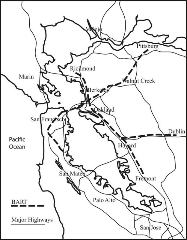
FIGURE 27.4 City centers and residential areas surrounding San Francisco Bay are connected by the Bay Area Rapid Transit system (BART).
The density of the city calls for urban parks. There are parks of all sizes, from small and medium sizes to Golden Gate Park, which stretches across a large area of city from the ocean almost to City Hall. These parks provide outdoor recreation spaces for a dense population. There are open grass spaces, woodlands, tennis courts, baseball fields, and golf courses. In Golden Gate Park, surrounding a music concourse, are the De Young Art Museum, The California Academy of Sciences, and the Japanese Tea Garden.
The Bay Area Rapid Transit (BART) system connects San Francisco with the East Bay Area (Figure 27.4). And Caltrans trains connect San Francisco with the peninsula south of the city. The BART trains run under Market Street, through the commercial center of the city.
In summary San Francisco with urban boundaries of ocean and bay to the west, north, and east, and Lake Merced and the City and County line on the south, developed into a dense walkable urban center. Multiple neighborhoods are connected, by a street grid and a municipal transit system of streetcars and buses, to each other and to the city center. Urban parks from small to large provide open space. And, the city is connected to the surrounding Bay Area through the BART rapid transit system, and the Caltrans rapid transit system.